Geolocate

Otwock topographic map

Click on the map to display elevation.

About this map
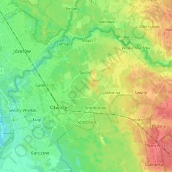
Name: Otwock topographic map, elevation, terrain.

Location: Otwock, Otwock County, Masovian Voivodeship, Poland (52.08341 21.21033 52.14877 21.36836)

Average elevation: 341 ft

Minimum elevation: 262 ft

Maximum elevation: 463 ft

Gear up for your next adventure:

📱Heavy-Duty Phone Cases - Drop-proof and waterproof protection for outdoor navigation
🎒Waterproof Dry Bags - Keep your electronics and maps dry inside your pack
🗺️NatGeo Topo Maps - High-quality waterproof printed topographic maps of US Parks
🎒Trekking Poles - Sturdy poles for balance and stability on rough terrain
🔋Rechargeable Batteries - Power up your outdoor devices

As an Amazon Associate, this site earns from qualifying purchases at no extra cost to you.