Geolocate

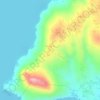
Janopol Occidental topographic map

Click on the map to display elevation.

About this map

Name: Janopol Occidental topographic map, elevation, terrain.

Location: Janopol Occidental, Tanauan, Batangas, Calabarzon, 4232, Philippines (14.06161 121.06668 14.10161 121.10668)

Average elevation: 322 ft

Minimum elevation: 13 ft

Maximum elevation: 538 ft

Other topographic maps

Click on a map to view its topography, its elevation and its terrain.

Talaga

Philippines > Batangas > Tanauan > Talaga

Average elevation: 443 ft

Maria Paz

Philippines > Batangas > Tanauan

Average elevation: 210 ft

Barangay 3

Philippines > Batangas > Tanauan > Hidalgo

Average elevation: 518 ft

Barangay 5

Philippines > Batangas > Tanauan > Hidalgo

Average elevation: 505 ft

Suplang

Philippines > Batangas > Tanauan

Average elevation: 810 ft

Ambulong

Philippines > Batangas > Tanauan > Maugat

Average elevation: 92 ft

Barangay 4

Philippines > Batangas > Tanauan

Average elevation: 466 ft

Darasa

Philippines > Batangas > Tanauan > Hidalgo

Average elevation: 568 ft

Laurel

Philippines > Batangas > Tanauan

Average elevation: 502 ft

Banjo West

Philippines > Batangas > Tanauan > Banjo Laurel

Average elevation: 509 ft

Darasa

Philippines > Batangas > Tanauan > Hidalgo

Average elevation: 568 ft

Ulango

Philippines > Batangas > Tanauan

Average elevation: 476 ft

Bañadero

Philippines > Batangas > Tanauan > Bañadero

Average elevation: 190 ft

Barangay 5

Philippines > Batangas > Tanauan > Hidalgo

Average elevation: 505 ft

Gear up for your next adventure:

⌚GPS Sports Watch - GPS watch for running, hiking and training
📦Dry Bags Set - Waterproof storage for electronics and clothes
🧭Map Reading Tools - Tools and kits for map navigation
🚑Emergency Bivvies - Heat-reflective sleeping bags for survival situations
🔊Portable Camp Speaker - Music and alerts at camp

As an Amazon Associate, this site earns from qualifying purchases at no extra cost to you.