Geolocate

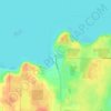
Spider Island topographic map

Click on the map to display elevation.

About this map

Name: Spider Island topographic map, elevation, terrain.

Location: Spider Island, Town of Liberty Grove, Door County, Wisconsin, United States (45.20650 -86.97857 45.21143 -86.97293)

Average elevation: 574 ft

Minimum elevation: 564 ft

Maximum elevation: 614 ft

Other topographic maps

Click on a map to view its topography, its elevation and its terrain.
Gear up for your next adventure:

🚗GPS Dash Cams - Record your scenic drives through mountain passes and canyons
🪶Survival Guide Book - Expert advice for emergency preparedness
🥄Camping Utensil Set - Lightweight utensils for outdoor meals
📱Heavy-Duty Phone Cases - Drop-proof and waterproof protection for outdoor navigation
🧭Hiking Compass - Precision compass for reliable navigation in the wilderness

As an Amazon Associate, this site earns from qualifying purchases at no extra cost to you.