Geolocate

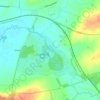
Stapleford topographic map

Click on the map to display elevation.

About this map

Name: Stapleford topographic map, elevation, terrain.

Location: Stapleford, Freeby, Saxby, Melton, Leicestershire, England, LE14 2SH, United Kingdom (52.73548 -0.82260 52.77548 -0.78260)

Average elevation: 312 ft

Minimum elevation: 246 ft

Maximum elevation: 449 ft

Other topographic maps

Click on a map to view its topography, its elevation and its terrain.
Langham Brook

United Kingdom > England > Leicestershire > Melton > Saxby > Freeby

Average elevation: 308 ft

Gear up for your next adventure:

🔋Rechargeable Batteries - Power up your outdoor devices
🎒Trail Energy Bars - High‑calorie bars for hiking energy
🛠️Backpacking Tool Kit - Essential toolkit for outdoor repairs
🌲Outdoor Survival Books - Best books on survival skills
🛡️Bear Spray Outdoor - Protection in bear country hikes

As an Amazon Associate, this site earns from qualifying purchases at no extra cost to you.