Geolocate

Peebles topographic map

Click on the map to display elevation.

About this map

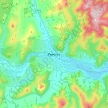
Name: Peebles topographic map, elevation, terrain.

Location: Peebles, Scottish Borders, Scotland, EH45 8SL, United Kingdom (55.61176 -3.22855 55.69176 -3.14855)

Average elevation: 902 ft

Minimum elevation: 486 ft

Maximum elevation: 1,962 ft

Gear up for your next adventure:

🕶️GPS Smartphone Mount - Secure mount for phone navigation
🪶Survival Guide Book - Expert advice for emergency preparedness
🧤Hiking Gloves - Protective gloves for rugged trails
🔦Powerful Headlamps - Ultra-bright hands-free lighting for night navigation
🍳Camping Cook Set - Complete cookware for outdoor meals

As an Amazon Associate, this site earns from qualifying purchases at no extra cost to you.