Geolocate

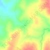
Bamba ward topographic map

Click on the map to display elevation.

About this map

Name: Bamba ward topographic map, elevation, terrain.

Location: Bamba ward, Ganze, Kilifi County, Kenya (-3.84360 39.08752 -3.31072 39.61855)

Average elevation: 830 ft

Minimum elevation: 387 ft

Maximum elevation: 1,650 ft

Other topographic maps

Click on a map to view its topography, its elevation and its terrain.

Bamba

Kenya > Kilifi County > Ganze > Bamba ward

Average elevation: 850 ft

Jila

Kenya > Kilifi County > Ganze > Ganze ward

Average elevation: 663 ft

Gear up for your next adventure:

🚪Portable Camp Chair - Foldable chair for comfort at camp
🏔️Mountain Trail Maps - High‑detail maps for popular peaks
🧺Microfiber Travel Towels - Compact and fast-drying towels for trail use
🎒Gear Packing Cubes - Organize your backpack efficiently
🛌Ultralight Sleeping Bags - Compact down bags for cold nights in the wilderness

As an Amazon Associate, this site earns from qualifying purchases at no extra cost to you.