Geolocate

Cikeruh topographic map

Click on the map to display elevation.

About this map
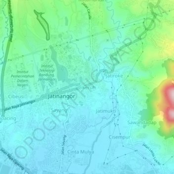
Name: Cikeruh topographic map, elevation, terrain.

Location: Cikeruh, Sumedang, West Java, 45363, Indonesia (-6.95235 107.75819 -6.91235 107.79819)

Average elevation: 2,457 ft

Minimum elevation: 2,208 ft

Maximum elevation: 3,547 ft

Other topographic maps

Click on a map to view its topography, its elevation and its terrain.

Anak Sungai Cimanuk

Indonesia > West Java > Sumedang

Average elevation: 184 ft

Gear up for your next adventure:

🏕️Tent Footprint - Protect your tent base from wear
💧Water Filtration Bottles - Safely drink from streams and lakes while exploring
🔋Rechargeable Batteries - Power up your outdoor devices
🧤Tactile Hiking Gloves - Keep hands warm while operating GPS and smartphone screens
🚗GPS Dash Cams - Record your scenic drives through mountain passes and canyons

As an Amazon Associate, this site earns from qualifying purchases at no extra cost to you.