Geolocate

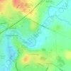
Patterdown topographic map

Click on the map to display elevation.

About this map

Name: Patterdown topographic map, elevation, terrain.

Location: Patterdown, Chippenham, Wiltshire, England, SN15 2NR, United Kingdom (51.42935 -2.15318 51.46935 -2.11318)

Average elevation: 213 ft

Minimum elevation: 128 ft

Maximum elevation: 358 ft

Other topographic maps

Click on a map to view its topography, its elevation and its terrain.
Monkton Park

United Kingdom > England > Wiltshire > Chippenham

Average elevation: 194 ft

Gear up for your next adventure:

📦Dry Bags Set - Waterproof storage for electronics and clothes
🪶Fire Starter Kit - Reliable fire starter for survival and camping
🧭Pro Hiking Compasses - High-accuracy liquid-filled compasses for topographic orientation
🥾Hiking Shoes - Durable and comfortable shoes for trail hiking
🧥Men's Rain Shells - Premium waterproof and breathable jackets for mountain weather

As an Amazon Associate, this site earns from qualifying purchases at no extra cost to you.