Geolocate

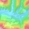
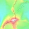
Mukta Top topographic map

Click on the map to display elevation.

About this map

Name: Mukta Top topographic map, elevation, terrain.

Location: Mukta Top, Bhatwari, Uttarkashi, Uttarakhand, India (30.81597 78.52428 30.81607 78.52438)

Average elevation: 10,305 ft

Minimum elevation: 8,202 ft

Maximum elevation: 12,339 ft

Other topographic maps

Click on a map to view its topography, its elevation and its terrain.

Kyarkoti Lake

India > Uttarakhand > Bhatwari

Average elevation: 13,264 ft

Harsil

India > Uttarakhand > Bhatwari

Average elevation: 9,058 ft

Pari Maatri Taal

India > Uttarakhand > Bhatwari

Average elevation: 14,577 ft

Kedar Tal

India > Uttarakhand > Bhatwari

Average elevation: 15,794 ft

Pulam Sumda

India > Uttarakhand > Bhatwari

Average elevation: 14,997 ft

Gangotri Glacier

India > Uttarakhand > Bhatwari

Average elevation: 17,254 ft

Dayara Bugyal

India > Uttarakhand > Bhatwari

Average elevation: 11,322 ft

Kedar Tal

India > Uttarakhand > Bhatwari

Average elevation: 15,794 ft

Kalindi Khal Area

India > Uttarakhand > Bhatwari

Average elevation: 19,216 ft

Harsil

India > Uttarakhand > Bhatwari

Average elevation: 9,058 ft

Gangotri Glacier

India > Uttarakhand > Bhatwari

Average elevation: 17,254 ft

Gear up for your next adventure:

🛡️Bear Spray Outdoor - Protection in bear country hikes
🔭Telescopic Hiking Pole - Adjustable pole for hiking stability
📷Action Cameras - Rugged cameras to document your journeys across rugged terrain
🧭GPS Watch Accessories - Bands and chargers for GPS watches
⛺Backpacking Tent - Lightweight and durable tent for multi‑day hikes

As an Amazon Associate, this site earns from qualifying purchases at no extra cost to you.