Geolocate

Austintown topographic map

Click on the map to display elevation.

About this map
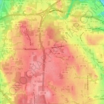
Name: Austintown topographic map, elevation, terrain.

Location: Austintown, Austintown Heights, Austintown Township, Mahoning County, Ohio, 44515, United States (41.06105 -80.79385 41.13387 -80.71101)

Average elevation: 1,073 ft

Minimum elevation: 846 ft

Maximum elevation: 1,184 ft

Mahoning County trails, hiking, mountain biking, running and outdoor activities

Gear up for your next adventure:

⛑️Personal Locator Beacon - Safety beacon for emergencies
📖Nature Tracking Books - Learn to track wildlife and terrain
🗺️NatGeo Topo Maps - High-quality waterproof printed topographic maps of US Parks
🧺Microfiber Travel Towels - Compact and fast-drying towels for trail use
🔦LED Headlamp - Bright and durable LED headlamp for night navigation

As an Amazon Associate, this site earns from qualifying purchases at no extra cost to you.