Geolocate

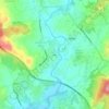
Gonça topographic map

Click on the map to display elevation.

About this map

Name: Gonça topographic map, elevation, terrain.

Location: Gonça, Guimarães, Braga, 4800-192, Portugal (41.49727 -8.27675 41.53209 -8.23026)

Average elevation: 1,234 ft

Minimum elevation: 407 ft

Maximum elevation: 1,883 ft

Other topographic maps

Click on a map to view its topography, its elevation and its terrain.

Guimarães

Portugal > Braga > Guimarães

Average elevation: 981 ft

Além

Portugal > Braga > Guimarães > Sande (Vila Nova)

Average elevation: 472 ft

Gear up for your next adventure:

☕Camping Coffee Makers - Enjoy premium coffee at the summit or campsite
🪑Ultralight Camp Chairs - Portable seating for resting after a long day of mapping
👟Trail Running Shoes - Lightweight shoes for trail runners
🛰️Handheld GPS Units - Professional satellite navigators for precise backcountry mapping
🔭Compact Binoculars - HD vision for scouting terrain and identifying distant landmarks

As an Amazon Associate, this site earns from qualifying purchases at no extra cost to you.