Geolocate

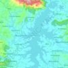
Sumberejo topographic map

Click on the map to display elevation.

About this map

Name: Sumberejo topographic map, elevation, terrain.

Location: Sumberejo, Wonogiri, Central Java, Indonesia (-7.94661 110.83759 -7.90661 110.87759)

Average elevation: 499 ft

Minimum elevation: 440 ft

Maximum elevation: 830 ft

Other topographic maps

Click on a map to view its topography, its elevation and its terrain.
Gear up for your next adventure:

🗺️NatGeo Topo Maps - High-quality waterproof printed topographic maps of US Parks
🍳Camping Cook Set - Complete cookware for outdoor meals
💧Water Filtration Bottles - Safely drink from streams and lakes while exploring
🪑Ultralight Camp Chairs - Portable seating for resting after a long day of mapping
🎒Day Hiking Backpack - Lightweight backpack perfect for day trips and outdoor adventures

As an Amazon Associate, this site earns from qualifying purchases at no extra cost to you.