Geolocate

Aston topographic map

Click on the map to display elevation.

About this map

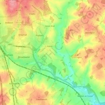
Name: Aston topographic map, elevation, terrain.

Location: Aston, East Hertfordshire, Hertfordshire, England, United Kingdom (51.85320 -0.16118 51.91547 -0.12087)

Average elevation: 325 ft

Minimum elevation: 171 ft

Maximum elevation: 469 ft

Other topographic maps

Click on a map to view its topography, its elevation and its terrain.

Gear up for your next adventure:

🗃️Trail First Aid Kit - Essential kit for outdoor injuries and emergencies
🎒Day Hiking Backpack - Lightweight backpack perfect for day trips and outdoor adventures
🩹Survival Bandages - High‑quality bandages for emergencies
🦶Carbon Trekking Poles - Reduce knee impact on steep descents with ultra-light poles
🏔️Mountain Trail Maps - High‑detail maps for popular peaks

As an Amazon Associate, this site earns from qualifying purchases at no extra cost to you.