Geolocate

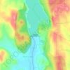
Manchanabele topographic map

Click on the map to display elevation.

About this map

Name: Manchanabele topographic map, elevation, terrain.

Location: Manchanabele, Magadi taluku, Bengaluru South, Karnataka, 561201, India (12.84689 77.31442 12.88689 77.35442)

Average elevation: 2,536 ft

Minimum elevation: 2,320 ft

Maximum elevation: 2,844 ft

Other topographic maps

Click on a map to view its topography, its elevation and its terrain.
Manchanabele

India > Karnataka > Magadi taluku

Average elevation: 2,530 ft

Gear up for your next adventure:

🔦Compact Flashlight - Reliable flashlight for emergencies
⛑️Personal Locator Beacon - Safety beacon for emergencies
🪶Trail Camera - Capture wildlife on your hikes
👟Trail Running Shoes - Lightweight shoes for trail runners
📱Solar Portable Charger - Solar power bank for charging devices off‑grid

As an Amazon Associate, this site earns from qualifying purchases at no extra cost to you.