Geolocate

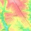
Winstone topographic map

Click on the map to display elevation.

About this map

Name: Winstone topographic map, elevation, terrain.

Location: Winstone, Cotswold District, Gloucestershire, England, United Kingdom (51.77020 -2.08411 51.79600 -2.02178)

Average elevation: 728 ft

Minimum elevation: 453 ft

Maximum elevation: 906 ft

Other topographic maps

Click on a map to view its topography, its elevation and its terrain.
Gear up for your next adventure:

⛺Backpacking Tent - Lightweight and durable tent for multi‑day hikes
🧦Merino Wool Socks - Moisture-wicking, blister-preventing socks for long treks
🏕️Family Camping Gear - Essentials for group camping trips
🔥Plasma Lighters - Windproof lighters that work in any weather condition
🧭Orienteering Set - Complete compass and map reading kit

As an Amazon Associate, this site earns from qualifying purchases at no extra cost to you.