
Thank you for supporting this site ❤️
Make a donation
Make a donation
Gear up for your next adventure:
As an Amazon Associate, this site earns from qualifying purchases at no extra cost to you.
小寨 topographic map
Click on the map to display elevation.
Thank you for supporting this site ❤️
Make a donation
Make a donation
Gear up for your next adventure:
As an Amazon Associate, this site earns from qualifying purchases at no extra cost to you.
About this map
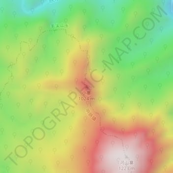
Name: 小寨 topographic map, elevation, terrain.
Location: 小寨, 响肠镇, 岳西县, 安庆市, 安徽省, 中国 (30.81105 116.41795 30.81115 116.41805)
Average elevation: 2,257 ft
Minimum elevation: 715 ft
Maximum elevation: 3,960 ft
Thank you for supporting this site ❤️
Make a donation
Make a donation
Gear up for your next adventure:
As an Amazon Associate, this site earns from qualifying purchases at no extra cost to you.