Geolocate

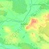
Clonlee topographic map

Click on the map to display elevation.

About this map

Name: Clonlee topographic map, elevation, terrain.

Location: Clonlee, Tulla ED, The Municipal District of Birr, County Offaly, Leinster, Ireland (53.06454 -7.75762 53.08730 -7.71907)

Average elevation: 486 ft

Minimum elevation: 292 ft

Maximum elevation: 1,027 ft

Other topographic maps

Click on a map to view its topography, its elevation and its terrain.

Cappincur

Ireland > County Offaly

Average elevation: 213 ft

Banagher

Ireland > County Offaly > Banagher

Average elevation: 141 ft

Charlestown

Ireland > County Offaly > Charlestown

Average elevation: 200 ft

Rahan

Ireland > County Offaly

Average elevation: 174 ft

Ballycommon

Ireland > County Offaly

Average elevation: 262 ft

Rath

Ireland > County Offaly

Average elevation: 217 ft

Daingean

Ireland > County Offaly

Average elevation: 269 ft

Durrow

Ireland > County Offaly

Average elevation: 217 ft

Mount Lucas

Ireland > County Offaly

Average elevation: 249 ft

Croghan

Ireland > County Offaly

Average elevation: 328 ft

Rathvilla

Ireland > County Offaly

Average elevation: 236 ft

Coolderry

Ireland > County Offaly

Average elevation: 351 ft

Harbour

Ireland > County Offaly

Average elevation: 203 ft

Rahan

Ireland > County Offaly

Average elevation: 174 ft

Gear up for your next adventure:

🥾Hiking Shoes - Durable and comfortable shoes for trail hiking
🌎3D Topographic Globes - Raised relief globes for a tactile understanding of geography
☕Camping Coffee Makers - Enjoy premium coffee at the summit or campsite
🧭Hiking Compass - Precision compass for reliable navigation in the wilderness
🛌Ultralight Sleeping Bags - Compact down bags for cold nights in the wilderness

As an Amazon Associate, this site earns from qualifying purchases at no extra cost to you.