
Thank you for supporting this site ❤️
Make a donation
Make a donation
Gear up for your next adventure:
As an Amazon Associate, this site earns from qualifying purchases at no extra cost to you.
Ogbomosho topographic map
Click on the map to display elevation.
Thank you for supporting this site ❤️
Make a donation
Make a donation
Gear up for your next adventure:
As an Amazon Associate, this site earns from qualifying purchases at no extra cost to you.
About this map
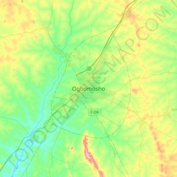
Name: Ogbomosho topographic map, elevation, terrain.
Location: Ogbomosho, Ogbomosho North, Oyo State, 210271, Nigeria (7.97300 4.09000 8.29300 4.41000)
Average elevation: 1,155 ft
Minimum elevation: 843 ft
Maximum elevation: 1,854 ft
Thank you for supporting this site ❤️
Make a donation
Make a donation
Gear up for your next adventure:
As an Amazon Associate, this site earns from qualifying purchases at no extra cost to you.