Geolocate

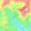
Mawiyah topographic map

Click on the map to display elevation.

About this map

Name: Mawiyah topographic map, elevation, terrain.

Location: Mawiyah, Mawiyah District, Ta'izz Governorate, Yemen (13.54295 44.30768 13.62295 44.38768)

Average elevation: 4,505 ft

Minimum elevation: 3,451 ft

Maximum elevation: 6,749 ft

Other topographic maps

Click on a map to view its topography, its elevation and its terrain.

Al Qahirah District

Yemen > Ta'izz Governorate

Average elevation: 4,265 ft

Cairo Castle

Yemen > Ta'izz Governorate > Ta'izz

Average elevation: 4,928 ft

المسراخ

Yemen > Ta'izz Governorate

Average elevation: 4,633 ft

المسراخ

Yemen > Ta'izz Governorate

Average elevation: 4,633 ft

Perim Island

Yemen > Ta'izz Governorate

Perim has been described as crab-shaped. The island is 5.63 km (3.50 mi) long and 2.85 km (1.77 mi) wide. It has a surface area of 13 km2 (5.0 sq mi) and rises to an altitude of 65 m (213 ft). Perim encloses a deep and comparatively large natural harbour on the southwestern coast. The fishing village of Mayyun…

Average elevation: 20 ft

Maqbanah District

Yemen > Ta'izz Governorate

Average elevation: 2,238 ft

Al Ma'afer District

Yemen > Ta'izz Governorate

Average elevation: 4,045 ft

Gear up for your next adventure:

🧥Men's Rain Shells - Premium waterproof and breathable jackets for mountain weather
🏥Hiking First Aid Kits - Comprehensive medical kits for remote trail injuries
🦺Reflective Outdoor Gear - Safety gear for low‑light conditions
🪶Paracord Bracelet - Survival bracelet with built‑in tools
🎒Trekking Poles - Sturdy poles for balance and stability on rough terrain

As an Amazon Associate, this site earns from qualifying purchases at no extra cost to you.