Geolocate

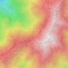
Tamura topographic map

Click on the map to display elevation.

About this map

Name: Tamura topographic map, elevation, terrain.

Location: Tamura, Fukushima Prefecture, Japan (37.27460 140.50414 37.53808 140.86196)

Average elevation: 1,568 ft

Minimum elevation: 646 ft

Maximum elevation: 3,855 ft

Other topographic maps

Click on a map to view its topography, its elevation and its terrain.
Osaka Prefecture

Japan

Average elevation: 617 ft

300M

Japan > Nagasaki

Average elevation: 722 ft

Takeda Castle

Japan > Asago

Average elevation: 571 ft

Akaishi Mountains

Japan > Oshika

Average elevation: 8,501 ft

Iwo to

Japan > Tokyo > Ogasawara

Average elevation: 0 ft

葭町

Japan > Matsumoto

Average elevation: 2,021 ft

Nishikigaoka-chuo Park

Japan > Sendai

Average elevation: 646 ft

Nakauonuma County

Japan

Average elevation: 1,985 ft

Mount Yatsugatake viewpoint

Japan > Suwa County > Fujimi

Average elevation: 5,715 ft

Gear up for your next adventure:

🔋Solar Power Banks - Keep your GPS and phone charged in remote wilderness areas
📷Action Camera - Capture your outdoor adventures in HD
🧭Pro Hiking Compasses - High-accuracy liquid-filled compasses for topographic orientation
🧭Map Reading Tools - Tools and kits for map navigation
🪶Multi‑Purpose Knife - Useful blade for camp and trail

As an Amazon Associate, this site earns from qualifying purchases at no extra cost to you.