Geolocate

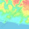
Cineam topographic map

Click on the map to display elevation.

About this map

Name: Cineam topographic map, elevation, terrain.

Location: Cineam, Tasikmalaya, West Java, 46198, Indonesia (-7.43000 108.31653 -7.35000 108.39653)

Average elevation: 938 ft

Minimum elevation: 276 ft

Maximum elevation: 2,592 ft

Other topographic maps

Click on a map to view its topography, its elevation and its terrain.

Cipatujah

Indonesia > West Java > Tasikmalaya

Average elevation: 541 ft

Cipanas

Indonesia > West Java > Tasikmalaya

Average elevation: 384 ft

Desa Arjasari

Indonesia > West Java > Tasikmalaya

Average elevation: 1,490 ft

Desa Cimanuk

Indonesia > West Java > Tasikmalaya

Average elevation: 105 ft

Gear up for your next adventure:

🔌Solar Panel Charger - Charge gear sustainably outdoors
🪑Portable Camp Table - Compact table for campsite meals
🌧️Backpack Rain Cover - Keep gear dry in wet weather
🔭Telescopic Hiking Pole - Adjustable pole for hiking stability
🧤Tactile Hiking Gloves - Keep hands warm while operating GPS and smartphone screens

As an Amazon Associate, this site earns from qualifying purchases at no extra cost to you.