
Forbes Road topographic map
Click on the map to display elevation.
About this map
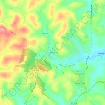
Name: Forbes Road topographic map, elevation, terrain.
Average elevation: 1,201 ft
Minimum elevation: 1,020 ft
Maximum elevation: 1,440 ft
Westmoreland County trails, hiking, mountain biking, running and outdoor activities
Other topographic maps
Click on a map to view its topography, its elevation and its terrain.
Crabtree Creek
United States > Pennsylvania > Westmoreland County > Salem Township > Crabtree
Average elevation: 1,119 ft