
Make a donation
Gear up for your next adventure:
As an Amazon Associate, this site earns from qualifying purchases at no extra cost to you.
St. Chrischona topographic map
Click on the map to display elevation.
Make a donation
Gear up for your next adventure:
As an Amazon Associate, this site earns from qualifying purchases at no extra cost to you.
St. Chrischona
Auf dem höchsten Punkt steht inmitten einiger Gebäude die Kirche St. Chrischona. Auf dem Berg etwas abseits, östlich der Besiedlung steht mit dem Fernsehturm St. Chrischona zudem das mit gut 250 Metern Höhe höchste freistehende Gebäude der Schweiz, das weitherum sichtbar ist.
Make a donation
Gear up for your next adventure:
As an Amazon Associate, this site earns from qualifying purchases at no extra cost to you.
About this map
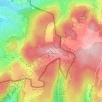
Name: St. Chrischona topographic map, elevation, terrain.
Location: St. Chrischona, Bettingen, Basel-Stadt, 4126, Schweiz (47.57297 7.68013 47.57307 7.68023)
Average elevation: 1,430 ft
Minimum elevation: 961 ft
Maximum elevation: 1,722 ft
Make a donation
Gear up for your next adventure:
As an Amazon Associate, this site earns from qualifying purchases at no extra cost to you.