Geolocate

Chappelle topographic map

Interactive map

Click on the map to display elevation.

About this map

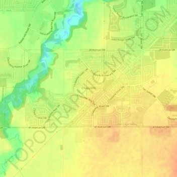
Name: Chappelle topographic map, elevation, terrain.

Location: Chappelle, Heritage Valley, Division No. 11, Alberta, Canada (53.39573 -113.60873 53.41039 -113.55305)

Average elevation: 2,280 ft

Minimum elevation: 2,198 ft

Maximum elevation: 2,326 ft

Other topographic maps

Click on a map to view its topography, its elevation and its terrain.

Sherwood Park

Canada > Alberta > Division No. 11

Sherwood Park, Division No. 11, Alberta, Canada

Average elevation: 2,267 ft

City of Wetaskiwin

Canada > Alberta > Division No. 11

City of Wetaskiwin, Division No. 11, Alberta, Canada

Average elevation: 2,493 ft

Fort Saskachewan

Canada > Alberta > Division No. 11

Fort Saskachewan, Division No. 11, Alberta, Canada

Average elevation: 2,090 ft

City of Leduc

Canada > Alberta > Division No. 11

City of Leduc, Division No. 11, Alberta, Canada

Average elevation: 2,385 ft

Edmonton

Canada > Alberta > Division No. 11

Edmonton, Alberta, Canada

Average elevation: 2,264 ft

Nisku

Canada > Alberta > Division No. 11

Nisku, Division No. 11, Alberta, T9E 0W8, Canada

Average elevation: 2,343 ft

City of Spruce Grove

Canada > Alberta > Division No. 11

City of Spruce Grove, Division No. 11, Alberta, Canada

Average elevation: 2,293 ft