Geolocate

91161 topographic map

Click on the map to display elevation.

About this map

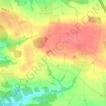
Name: 91161 topographic map, elevation, terrain.

Location: 91161, Grauwinkl, Hilpoltstein, Roth, Bavaria, Germany (49.17217 11.23422 49.17227 11.23432)

Average elevation: 1,437 ft

Minimum elevation: 1,296 ft

Maximum elevation: 1,532 ft

Gear up for your next adventure:

🛌Ultralight Sleeping Bags - Compact down bags for cold nights in the wilderness
🪶LED Camping Lantern - Bright lantern for camp lighting
🎒Hydration Pack - Hands‑free water reservoir for long hikes
🔭Compact Binoculars - HD vision for scouting terrain and identifying distant landmarks
🧭Orienteering Set - Complete compass and map reading kit

As an Amazon Associate, this site earns from qualifying purchases at no extra cost to you.