
Thank you for supporting this site ❤️
Make a donation
Make a donation
Gear up for your next adventure:
As an Amazon Associate, this site earns from qualifying purchases at no extra cost to you.
Zele topographic map
Click on the map to display elevation.
Thank you for supporting this site ❤️
Make a donation
Make a donation
Gear up for your next adventure:
As an Amazon Associate, this site earns from qualifying purchases at no extra cost to you.
About this map
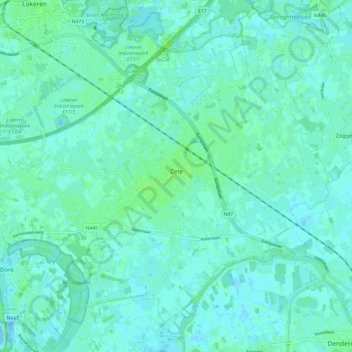
Name: Zele topographic map, elevation, terrain.
Location: Zele, Dendermonde, East Flanders, Flanders, 9240, Belgium (51.03212 3.97182 51.10236 4.09252)
Average elevation: 10 ft
Minimum elevation: -13 ft
Maximum elevation: 36 ft
Thank you for supporting this site ❤️
Make a donation
Make a donation
Gear up for your next adventure:
As an Amazon Associate, this site earns from qualifying purchases at no extra cost to you.
Other topographic maps
Click on a map to view its topography, its elevation and its terrain.
Boonwijk
Belgium > East Flanders > Dendermonde > Dendermonde > Sint-Gillis-bij-Dendermonde
Average elevation: 13 ft