
Thank you for supporting this site ❤️
Make a donation
Make a donation
Gear up for your next adventure:
As an Amazon Associate, this site earns from qualifying purchases at no extra cost to you.
São Julião e Silva topographic map
Click on the map to display elevation.
Thank you for supporting this site ❤️
Make a donation
Make a donation
Gear up for your next adventure:
As an Amazon Associate, this site earns from qualifying purchases at no extra cost to you.
About this map
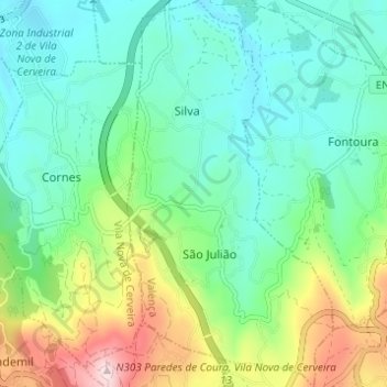
Name: São Julião e Silva topographic map, elevation, terrain.
Location: São Julião e Silva, Valença, Viana do Castelo, Portugal (41.92717 -8.66884 41.97282 -8.63575)
Average elevation: 417 ft
Minimum elevation: 59 ft
Maximum elevation: 1,332 ft
Thank you for supporting this site ❤️
Make a donation
Make a donation
Gear up for your next adventure:
As an Amazon Associate, this site earns from qualifying purchases at no extra cost to you.