
Thank you for supporting this site ❤️
Make a donation
Make a donation
Gear up for your next adventure:
As an Amazon Associate, this site earns from qualifying purchases at no extra cost to you.
Mazenzele topographic map
Click on the map to display elevation.
Thank you for supporting this site ❤️
Make a donation
Make a donation
Gear up for your next adventure:
As an Amazon Associate, this site earns from qualifying purchases at no extra cost to you.
About this map
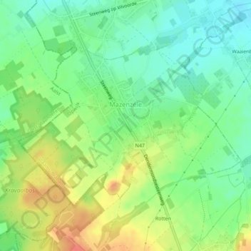
Name: Mazenzele topographic map, elevation, terrain.
Location: Mazenzele, Opwijk, Hal-Vilvorde, Brabant flamand, Belgique (50.93202 4.15345 50.94919 4.18496)
Average elevation: 164 ft
Minimum elevation: 92 ft
Maximum elevation: 266 ft
Thank you for supporting this site ❤️
Make a donation
Make a donation
Gear up for your next adventure:
As an Amazon Associate, this site earns from qualifying purchases at no extra cost to you.