
Thank you for supporting this site ❤️
Make a donation
Make a donation
Gear up for your next adventure:
As an Amazon Associate, this site earns from qualifying purchases at no extra cost to you.
Etampitiya topographic map
Click on the map to display elevation.
Thank you for supporting this site ❤️
Make a donation
Make a donation
Gear up for your next adventure:
As an Amazon Associate, this site earns from qualifying purchases at no extra cost to you.
About this map
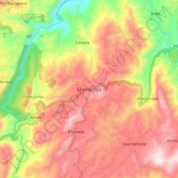
Name: Etampitiya topographic map, elevation, terrain.
Location: Etampitiya, Badulla District, Uva Province, Sri Lanka (6.89606 80.94927 6.97606 81.02927)
Average elevation: 3,428 ft
Minimum elevation: 1,962 ft
Maximum elevation: 4,554 ft
Thank you for supporting this site ❤️
Make a donation
Make a donation
Gear up for your next adventure:
As an Amazon Associate, this site earns from qualifying purchases at no extra cost to you.