
Tolosa topographic map
Click on the map to display elevation.
About this map
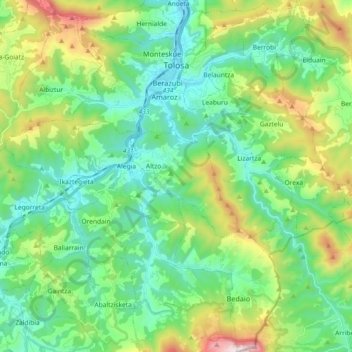
Name: Tolosa topographic map, elevation, terrain.
Location: Tolosa, Guipuscoa, Pays basque autonome, 20400, Espagne (43.02970 -2.16131 43.16312 -2.00925)
Average elevation: 1,273 ft
Minimum elevation: 217 ft
Maximum elevation: 4,108 ft
Other topographic maps
Click on a map to view its topography, its elevation and its terrain.
Biaritz
Espagne > Pays basque autonome > Arabako lautada/Llanada Alavesa > Agurain/Salvatierra
Average elevation: 1,965 ft