Geolocate

Lithopolis topographic map

Click on the map to display elevation.

About this map

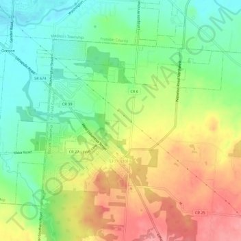
Name: Lithopolis topographic map, elevation, terrain.

Location: Lithopolis, Bloom Township, Fairfield County, Ohio, 43136, United States (39.79491 -82.83762 39.82473 -82.78301)

Average elevation: 873 ft

Minimum elevation: 735 ft

Maximum elevation: 1,047 ft

Fairfield County trails, hiking, mountain biking, running and outdoor activities

Other topographic maps

Click on a map to view its topography, its elevation and its terrain.

Hamburg

United States > Ohio > Fairfield County

Average elevation: 1,040 ft

Pickerington

United States > Ohio > Fairfield County > Pickerington

Average elevation: 860 ft

Oakland

United States > Ohio > Fairfield County

Average elevation: 1,040 ft

Gear up for your next adventure:

🦺Reflective Outdoor Gear - Safety gear for low‑light conditions
🔦Powerful Headlamps - Ultra-bright hands-free lighting for night navigation
🛰️Satellite Messengers - Emergency SOS and two-way messaging for off-grid adventures
🔭Compact Binoculars - HD vision for scouting terrain and identifying distant landmarks
🌄Hiking Binoculars - Compact binoculars for scenic views and trail spotting

As an Amazon Associate, this site earns from qualifying purchases at no extra cost to you.