
Robinwood topographic map
Click on the map to display elevation.
About this map
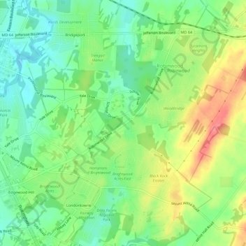
Name: Robinwood topographic map, elevation, terrain.
Location: Robinwood, Washington County, Maryland, United States (39.61004 -77.69123 39.64427 -77.63656)
Average elevation: 574 ft
Minimum elevation: 472 ft
Maximum elevation: 719 ft
Washington County trails, hiking, mountain biking, running and outdoor activities