
Make a donation
Gear up for your next adventure:
As an Amazon Associate, this site earns from qualifying purchases at no extra cost to you.
Vadersdorf topographic map
Click on the map to display elevation.
Make a donation
Gear up for your next adventure:
As an Amazon Associate, this site earns from qualifying purchases at no extra cost to you.
Vadersdorf
400 Meter südlich von Vadersdorf lag auf einer kleinen Anhöhe die in der Dorfgeschichte seit Jahrhunderten erwähnte Herrschafts-Windmühle. Sie besaß eine 3 ha große Bauernstelle und vermutlich eine Schankkonzession. Sechs Nachbardörfer waren ihr als Zwangsgäste zugeteilt. Die Vadersdorfer Regierungsmühle, die wahrscheinlich eine der beiden ältesten Wyntmölen Fehmarns von 1456 ist, brannte 1680 ab und wurde nicht wieder aufgebaut.
Make a donation
Gear up for your next adventure:
As an Amazon Associate, this site earns from qualifying purchases at no extra cost to you.
About this map
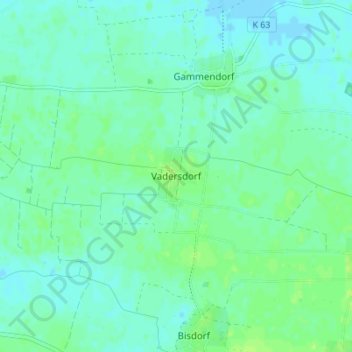
Name: Vadersdorf topographic map, elevation, terrain.
Average elevation: 16 ft
Minimum elevation: -7 ft
Maximum elevation: 36 ft
Make a donation
Gear up for your next adventure:
As an Amazon Associate, this site earns from qualifying purchases at no extra cost to you.