
Make a donation
Gear up for your next adventure:
As an Amazon Associate, this site earns from qualifying purchases at no extra cost to you.
Putney topographic map
Click on the map to display elevation.
Make a donation
Gear up for your next adventure:
As an Amazon Associate, this site earns from qualifying purchases at no extra cost to you.
About this map
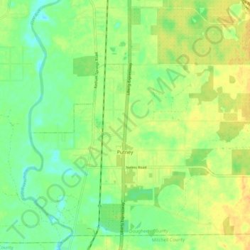
Name: Putney topographic map, elevation, terrain.
Location: Putney, Dougherty County, Georgia, United States (31.44018 -84.15653 31.51676 -84.06140)
Average elevation: 197 ft
Minimum elevation: 148 ft
Maximum elevation: 246 ft
Dougherty County trails, hiking, mountain biking, running and outdoor activities
Make a donation
Gear up for your next adventure:
As an Amazon Associate, this site earns from qualifying purchases at no extra cost to you.
Other topographic maps
Click on a map to view its topography, its elevation and its terrain.
Azalea Terrace
United States > Georgia > Dougherty County > Albany > Azalea Terrace
Average elevation: 197 ft
Make a donation
Gear up for your next adventure:
As an Amazon Associate, this site earns from qualifying purchases at no extra cost to you.