Geolocate

Naigaon topographic map

Click on the map to display elevation.

About this map

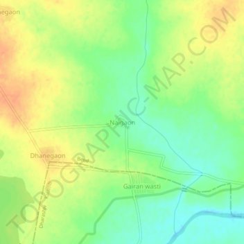
Name: Naigaon topographic map, elevation, terrain.

Location: Naigaon, Kaij, Beed, Maharashtra, India (18.57236 76.16124 18.61236 76.20124)

Average elevation: 2,100 ft

Minimum elevation: 2,034 ft

Maximum elevation: 2,162 ft

Gear up for your next adventure:

📦Gear Storage Bags - Organize and protect outdoor equipment
🛶Inflatable Kayak - Portable kayak for rivers, lakes, and expeditions
🩹Survival Bandages - High‑quality bandages for emergencies
🦺Reflective Outdoor Gear - Safety gear for low‑light conditions
🧦Merino Wool Socks - Moisture-wicking, blister-preventing socks for long treks

As an Amazon Associate, this site earns from qualifying purchases at no extra cost to you.