Geolocate

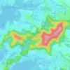
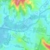
Mount White topographic map

Click on the map to display elevation.

About this map

Name: Mount White topographic map, elevation, terrain.

Location: Mount White, Gosford, New South Wales, Australia (-33.47588 151.15837 -33.42807 151.22110)

Average elevation: 404 ft

Minimum elevation: -3 ft

Maximum elevation: 883 ft

Other topographic maps

Click on a map to view its topography, its elevation and its terrain.
Mount White

Australia > New South Wales > Gosford

Average elevation: 456 ft

Wyong River

Australia > New South Wales > Gosford

Average elevation: 574 ft

Wamberal Beach

Australia > New South Wales > Gosford

Average elevation: 23 ft

Mount Elliot

Australia > New South Wales > Gosford

Average elevation: 302 ft

Erina Creek

Australia > New South Wales > Gosford

Average elevation: 75 ft

Gear up for your next adventure:

📡GPS Antenna Upgrade - Enhance GPS reception in remote terrain
🛰️Satellite Messengers - Emergency SOS and two-way messaging for off-grid adventures
🧯Portable Fire Pit - Compact fire pit for camping spots
🪶Thermal Camp Blanket - Extra warmth for cold nights
🎒Outdoor Daypacks - Lightweight backpacks designed for carrying maps and essential gear

As an Amazon Associate, this site earns from qualifying purchases at no extra cost to you.