
Thank you for supporting this site ❤️
Make a donation
Make a donation
Gear up for your next adventure:
As an Amazon Associate, this site earns from qualifying purchases at no extra cost to you.
Yayla Gökben topographic map
Click on the map to display elevation.
Thank you for supporting this site ❤️
Make a donation
Make a donation
Gear up for your next adventure:
As an Amazon Associate, this site earns from qualifying purchases at no extra cost to you.
About this map
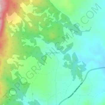
Name: Yayla Gökben topographic map, elevation, terrain.
Location: Yayla Gökben, Seydikemer, Muğla, Aegean Region, Turkey (36.87802 29.60880 36.91802 29.64880)
Average elevation: 4,560 ft
Minimum elevation: 4,072 ft
Maximum elevation: 5,807 ft
Thank you for supporting this site ❤️
Make a donation
Make a donation
Gear up for your next adventure:
As an Amazon Associate, this site earns from qualifying purchases at no extra cost to you.