
Make a donation
Gear up for your next adventure:
As an Amazon Associate, this site earns from qualifying purchases at no extra cost to you.
Thomas Township topographic map
Click on the map to display elevation.
Make a donation
Gear up for your next adventure:
As an Amazon Associate, this site earns from qualifying purchases at no extra cost to you.
About this map
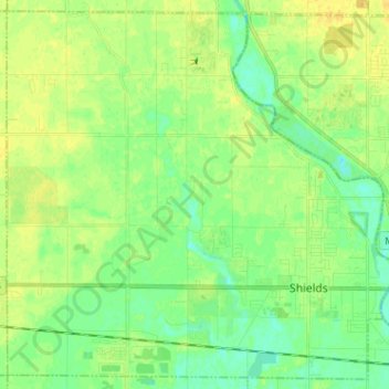
Name: Thomas Township topographic map, elevation, terrain.
Location: Thomas Township, Saginaw County, Michigan, United States (43.39415 -84.17064 43.48191 -84.04314)
Average elevation: 610 ft
Minimum elevation: 577 ft
Maximum elevation: 643 ft
Make a donation
Gear up for your next adventure:
As an Amazon Associate, this site earns from qualifying purchases at no extra cost to you.
Other topographic maps
Click on a map to view its topography, its elevation and its terrain.
Shattuckville
United States > Michigan > Saginaw County > Saginaw Charter Township
Average elevation: 614 ft
Shattuckville
United States > Michigan > Saginaw County > Saginaw Charter Township
Average elevation: 614 ft