
Ludshott Common topographic map
Click on the map to display elevation.
About this map
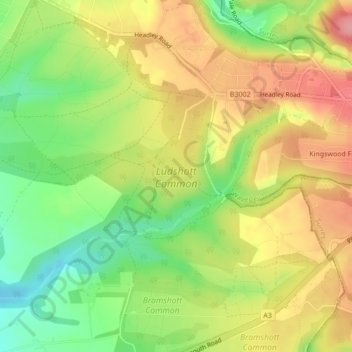
Name: Ludshott Common topographic map, elevation, terrain.
Average elevation: 531 ft
Minimum elevation: 354 ft
Maximum elevation: 699 ft
Other topographic maps
Click on a map to view its topography, its elevation and its terrain.
Cold Ash Hill
United Kingdom > England > Hampshire > East Hampshire > Bramshott
Average elevation: 413 ft