
Make a donation
Gear up for your next adventure:
As an Amazon Associate, this site earns from qualifying purchases at no extra cost to you.
Teresén topographic map
Click on the map to display elevation.
Make a donation
Gear up for your next adventure:
As an Amazon Associate, this site earns from qualifying purchases at no extra cost to you.
About this map
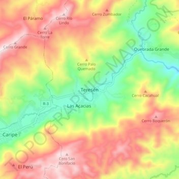
Name: Teresén topographic map, elevation, terrain.
Average elevation: 3,681 ft
Minimum elevation: 2,421 ft
Maximum elevation: 4,980 ft
Make a donation
Gear up for your next adventure:
As an Amazon Associate, this site earns from qualifying purchases at no extra cost to you.
Other topographic maps
Click on a map to view its topography, its elevation and its terrain.
Parque Nacional El Guácharo
Venezuela > Estado Monagas > Municipio Caripe
La Cueva del Guácharo fue visitada por el naturalista alemán Alexander von Humboldt el 18 de septiembre de 1799, aunque anteriormente ya era visitada constantemente por indígenas de la Etnia Chaima, la cueva de guácharo era importante para esta etnia y representa una parte importante de sus creencias, y…
Average elevation: 1,283 ft
Caripe
Venezuela > Estado Monagas > Municipio Caripe
Caripe se ubica en un valle situado en el macizo de Caripe. El clima del lugar es de tipo tropical, con temperaturas de 22 °C. El pueblo se encuentra a una altitud de unos 928 msnm. Sus coordenadas son 63° 28’ y 63° 32’ de Longitud Oeste, y 10° 9’ 45” y 10° 12’ 20” de Latitud Norte. Limita por…
Average elevation: 3,632 ft