Geolocate

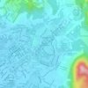
Kampung Simpang topographic map

Click on the map to display elevation.

About this map

Name: Kampung Simpang topographic map, elevation, terrain.

Location: Kampung Simpang, Taiping, Larut, Matang and Selama, Perak, 34700, Malaysia (4.79788 100.68622 4.83788 100.72622)

Average elevation: 33 ft

Minimum elevation: 7 ft

Maximum elevation: 72 ft

Other topographic maps

Click on a map to view its topography, its elevation and its terrain.

Kampung Kurnia Jaya Tambahan

Malaysia > Perak > Taiping

Average elevation: 23 ft

Taiping Lake Gardens

Malaysia > Perak > Taiping > Kampung Peng Long

Average elevation: 161 ft

Sungai Reba

Malaysia > Perak > Taiping

Average elevation: 13 ft

Taiping Lake Gardens

Malaysia > Perak > Taiping > Kampung Peng Long

Average elevation: 161 ft

Larut River

Malaysia > Perak > Taiping

Average elevation: 10 ft

Sungai Jebong

Malaysia > Perak > Taiping

Average elevation: 151 ft

Gear up for your next adventure:

🚑Emergency Bivvies - Heat-reflective sleeping bags for survival situations
📷Action Cameras - Rugged cameras to document your journeys across rugged terrain
📖Nature Tracking Books - Learn to track wildlife and terrain
🕶️GPS Smartphone Mount - Secure mount for phone navigation
🧤Hiking Gloves - Protective gloves for rugged trails

As an Amazon Associate, this site earns from qualifying purchases at no extra cost to you.