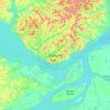
Aleixo topographic map
Click on the map to display elevation.
About this map

Name: Aleixo topographic map, elevation, terrain.
Location: Aleixo, Manaus, Amazonas, Região Norte, 69000-000, Brasil (-3.10598 -60.00918 -3.07049 -59.97239)
Average elevation: 171 ft
Minimum elevation: 79 ft
Maximum elevation: 292 ft
Other topographic maps
Click on a map to view its topography, its elevation and its terrain.