Geolocate

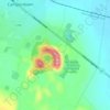
Camperdown topographic map

Click on the map to display elevation.

About this map

Name: Camperdown topographic map, elevation, terrain.

Location: Camperdown, Victoria, 3260, Australia (-38.27777 143.07568 -38.18031 143.21857)

Average elevation: 541 ft

Minimum elevation: 331 ft

Maximum elevation: 994 ft

Other topographic maps

Click on a map to view its topography, its elevation and its terrain.
Mount Sugarloaf

Australia > Victoria > Camperdown

Average elevation: 659 ft

Mount Leura

Australia > Victoria > Camperdown

Average elevation: 627 ft

Gear up for your next adventure:

🚗GPS Dash Cams - Record your scenic drives through mountain passes and canyons
🔦Compact Flashlight - Reliable flashlight for emergencies
🧯Portable Fire Pit - Compact fire pit for camping spots
🪄Magnetic Compass - Accurate compass for navigation
🌡️Handheld Weather Meters - Measure wind, temp, and pressure for safe mountain travel

As an Amazon Associate, this site earns from qualifying purchases at no extra cost to you.