Geolocate

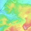
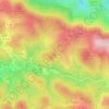
Paraza topographic map

Click on the map to display elevation.

About this map

Name: Paraza topographic map, elevation, terrain.

Location: Paraza, Narbonne, Aude, Occitania, Metropolitan France, 11200, France (43.23762 2.77939 43.27462 2.84670)

Average elevation: 177 ft

Minimum elevation: 66 ft

Maximum elevation: 482 ft

Other topographic maps

Click on a map to view its topography, its elevation and its terrain.
Pech d'Aspe

France > Occitania > Aude > Mas-des-Cours

Average elevation: 1,145 ft

Cervière

France > Occitania > Aude > Armissan

Average elevation: 308 ft

La Gare

France > Occitania > Aude > Villeneuve-la-Comptal

Average elevation: 722 ft

La Franqui

France > Occitania > Aude > Leucate

Average elevation: 49 ft

Saint-Pierre-la-Mer

France > Occitania > Aude

Average elevation: 66 ft

Port-Leucate

France > Occitania > Aude > Leucate

Average elevation: 0 ft

Le Castelas

France > Occitania > Aude > Rennes-le-Château

Average elevation: 1,250 ft

Pic de Nore

France > Occitania > Aude > Pradelles-Cabardès

Average elevation: 3,488 ft

Bourdials

France > Occitania > Aude > Castans

Average elevation: 2,444 ft

Pech d'Aspe

France > Occitania > Aude > Mas-des-Cours

Average elevation: 1,145 ft

Pech Cardou

France > Occitania > Aude > Serres

Average elevation: 1,401 ft

Gear up for your next adventure:

🚑Emergency Bivvies - Heat-reflective sleeping bags for survival situations
🗺️NatGeo Topo Maps - High-quality waterproof printed topographic maps of US Parks
🩳Quick‑Dry Hiking Shorts - Comfortable and quick‑dry shorts for summer hiking
💧Water Purification System - Clean water on the trail with reliable purifiers
🪶Survival Guide Book - Expert advice for emergency preparedness

As an Amazon Associate, this site earns from qualifying purchases at no extra cost to you.