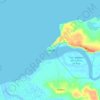
Mahajanga II topographic map
Click on the map to display elevation.
About this map

Name: Mahajanga II topographic map, elevation, terrain.
Location: Mahajanga II, Boeny, Province de Mahajanga, Madagascar (-15.98698 46.29727 -15.19846 47.18102)
Average elevation: 115 ft
Minimum elevation: -13 ft
Maximum elevation: 863 ft
Other topographic maps
Click on a map to view its topography, its elevation and its terrain.




Marovoay
Madagascar > Boeny > Marovoay
Altitude : 22 mètres au-dessus du niveau de la mer. Climat : Climat de savane avec hiver sec (classification Köppen Aw).
Average elevation: 26 ft