
Balige topographic map
Click on the map to display elevation.
About this map
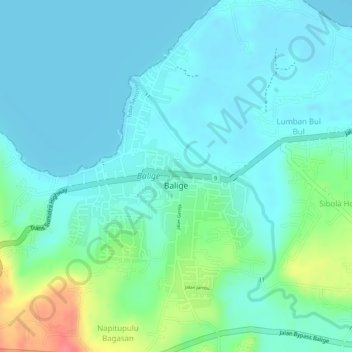
Name: Balige topographic map, elevation, terrain.
Location: Balige, Toba, North Sumatra, Sumatra, Indonesia (2.32392 99.05829 2.34448 99.07268)
Average elevation: 3,009 ft
Minimum elevation: 2,949 ft
Maximum elevation: 3,196 ft
Other topographic maps
Click on a map to view its topography, its elevation and its terrain.