Geolocate

Hardisty topographic map

Click on the map to display elevation.

About this map

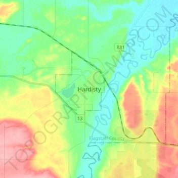
Name: Hardisty topographic map, elevation, terrain.

Location: Hardisty, Town of Hardisty, Alberta, T0B 1V0, Canada (52.62960 -111.34938 52.70960 -111.26938)

Average elevation: 2,096 ft

Minimum elevation: 1,965 ft

Maximum elevation: 2,326 ft

Gear up for your next adventure:

Solar GPS Watches - Advanced multisport watches with built-in topographic maps
🛡️Insect Repellent - Protection against bugs during outdoor activities
🛶Inflatable Kayak - Portable kayak for rivers, lakes, and expeditions
🧣Merino Neck Gaiters - Multi-functional headwear for wind and sun protection
🗃️Trail First Aid Kit - Essential kit for outdoor injuries and emergencies

As an Amazon Associate, this site earns from qualifying purchases at no extra cost to you.