Geolocate

Findhorn Bay topographic map

Click on the map to display elevation.

About this map

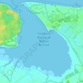
Name: Findhorn Bay topographic map, elevation, terrain.

Location: Findhorn Bay, Findhorn, Moray, Scotland, United Kingdom (57.63107 -3.64744 57.66228 -3.58014)

Average elevation: 10 ft

Minimum elevation: -3 ft

Maximum elevation: 79 ft

Gear up for your next adventure:

🧤Hiking Gloves - Protective gloves for rugged trails
🪶LED Camping Lantern - Bright lantern for camp lighting
🥄Camping Utensil Set - Lightweight utensils for outdoor meals
🪑Portable Camp Table - Compact table for campsite meals
🧼Biodegradable Camping Soap - Eco‑friendly soap for outdoor hygiene

As an Amazon Associate, this site earns from qualifying purchases at no extra cost to you.