
Möklinta topographic map
Interactive map
Click on the map to display elevation.
About this map
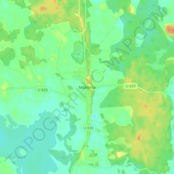
Name: Möklinta topographic map, elevation, terrain.
Location: Möklinta, Sala kommun, Västmanlands län, Zweden (60.06603 16.52478 60.10603 16.56478)
Average elevation: 233 ft
Minimum elevation: 190 ft
Maximum elevation: 308 ft
Other topographic maps
Click on a map to view its topography, its elevation and its terrain.
Odensvi
Odensvi, Köpings kommun, Västmanlands län, Zweden
Average elevation: 138 ft