
Sala kommun topographic map
Interactive map
Click on the map to display elevation.
About this map
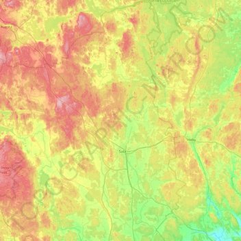
Name: Sala kommun topographic map, elevation, terrain.
Location: Sala kommun, Västmanlands län, Zweden (59.75530 16.09240 60.19505 16.83704)
Average elevation: 236 ft
Minimum elevation: 59 ft
Maximum elevation: 472 ft
Other topographic maps
Click on a map to view its topography, its elevation and its terrain.